
Aerial Photos of Siloam Springs
Originally posted on April 4, 2018
Since Cecil Smith Field, Siloam Springs’ municipal airport, opened in 1962, it has been populated with general aviation airplanes. Many local private aviators have used Smith Field to help them see the town from the air. This week’s featured photographs were donated to the Siloam Springs Museum in 1983, and they were likely taken that same year or shortly before. The photographs document a private pilot’s flight around the Siloam Springs area. They provide a unique perspective of Siloam in the early 1980’s. For the purpose of clarification, we have provided current satellite photos to show roughly what area each photo depicts.
The first photo was likely taken shortly after the pilot took off. It shows Smith Field as it was around 1983. The small airport opened in 1962. Today, it has several more hangars, as one can see in the current photo. It is now home to multiple businesses and private planes.


The next photo, below, looks north northwest toward the intersection of Highway 412 and Holly Street in the foreground and Siloam Springs High School (the current middle school) further back. This complex served as Siloam Springs’ local high school from 1963 to 2011. When comparing this photo and the current photo below it, notice how many businesses have been added to the intersection of Highway 412 and Holly Street.


The photo below again shows Highway 412 in the foreground and the school further in the background. Today, the empty field in the middle of the photo is Siloam Springs’ post office.


The following photo looks east at the north end of the downtown area. Notice the creek and the University Street bridge on the right, and Northside Elementary on the left. The park next to the creek (called Bob Henry Park today) has seen several improvements since this photo was taken.

The next photo looks north northwest across Highway 59 and the railroad tracks at downtown Gentry, Arkansas. Between the old and current photos, notice the businesses which have been added to the area in the foreground of the 1983 photo.


The following photo shows the SWEPCO power plant as it appeared in the early 1980’s. Construction on the plant began in 1975.


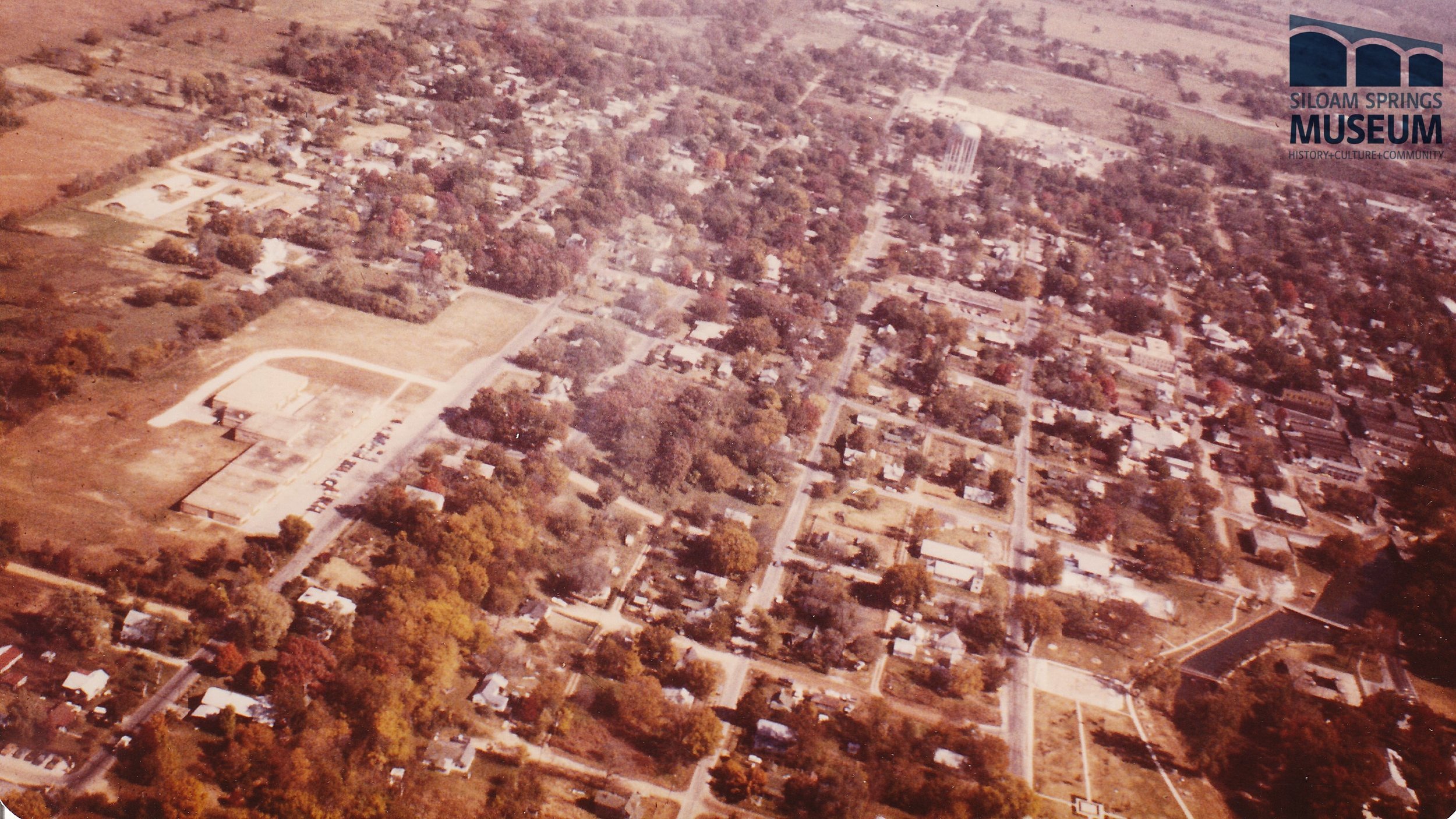
The photo below looks north northwest toward downtown Siloam Springs. The prominently visible street running north on the left is Mount Olive Street.


The photo below looks east at the church just north of the present day Siloam Springs Middle School. The entrance to the school’s parking lot can be seen on the right side of the photo. The church pictured still stands today, though it has been added to through the years.


Next, the pilot took a photo of both the school and the church (see previous photos) looking east southeast.


Finally, the pilot took a photo of what would have been the La-Z-Boy plant at the time. La-Z-Boy occupied this complex from 1973 until the mid 1990’s. Today, the building is owned by Ozark Electronics Repair. La-Z-Boy has moved to a location just north of town.Finally, the pilot took a photo of what would have been the La-Z-Boy plant at the time. La-Z-Boy occupied this complex from 1973 until the mid 1990’s. Today, the building is owned by Ozark Electronics Repair. La-Z-Boy has moved to a location just north of town.


Written by Chuck McClary using information from the Siloam Springs Archives, Images of America: Siloam Springs by Don Warden, and Hico, a Heritage: Siloam Springs by Maggie Smith.
Photos provided by the Siloam Springs Museum archives and Google Earth.