
Flood in Twin Springs Park, 1928
Originally posted on February 13, 2018
In Siloam Springs, summer seems to be a time for floods. Some are large enough only to cause some inconvenience and minor amounts of damage. Others are large enough to cause large amounts of damage, injuries, and even deaths. Siloam’s first recorded large-scale flood came in May of 1892. In 1881, when Siloam Springs became an incorporated town, its population was a healthy 2,264 people. By the time of the 1890 census, the population of Siloam had already dropped to 821. Only two years later, the 1892 flood hit Sager Creek, completely washing away two businesses and undermining one business at the south end of St. Nicholas Avenue (present day Broadway), and causing considerable damage and three deaths elsewhere in town.

Nobby Clothing Company was undermined by the 1892 flood.
Despite the population slump surrounding the flood, the town was able to rebuild and recover, due in large part to the economic boom which followed the building of a railroad line through town in 1894. Another large flood which would damage or destroy many homes and businesses came in June of 1974.

During the 1974 flood, parts of downtown Siloam Springs were under 7 feet of water.
These major floods were large enough to live on in Siloam Springs’ collective memory. Though they show an impressive amount of water, however, the photos below depict one of Siloam Springs’ more “routine” floods in August of 1928. These photos from our archives, donated in 1972, show a rushing and bloated Sager Creek from the Twin Springs area at the south end of what is now Broadway Street. The water has risen beyond the raised walkway on the south side of the bend in the creek, and a small crowd has gathered to look at what has become a raging current.

A crowd gathers on the south bank of Sager Creek, near Twin Springs.

This photo was taken from the south bank of Sager Creek looking toward the Twin Springs foot bridge.
Whether on purpose or accidentally, the photographer has chosen a shutter speed slow enough to show the movement of the rushing water, illustrating the point that caution is always a good rule of thumb in flood conditions. Partially because of the frequent floods on Sager Creek, some things have been changed or updated at Twin Springs Park. In the modern photographs below, take note of the new location of the gazebo, slightly farther away from the hill. The houses along the southern bank of the creek bend are also no longer present. Though not shown in the archival photographs, the northern bank of Sager Creek is built up today to prevent this type of flooding, but it was not built up in 1928.
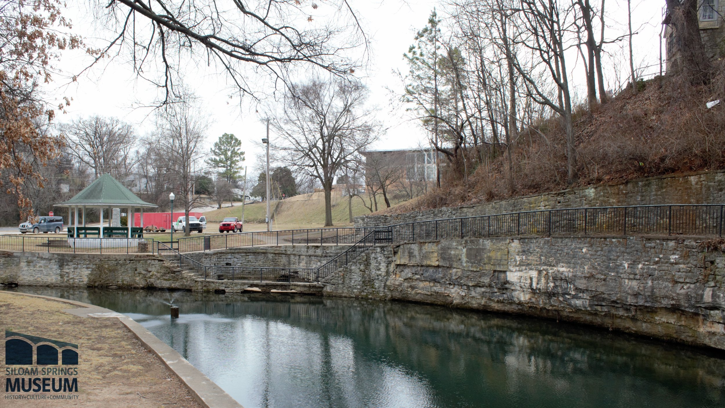
Modern photo looking south toward Twin Springs.
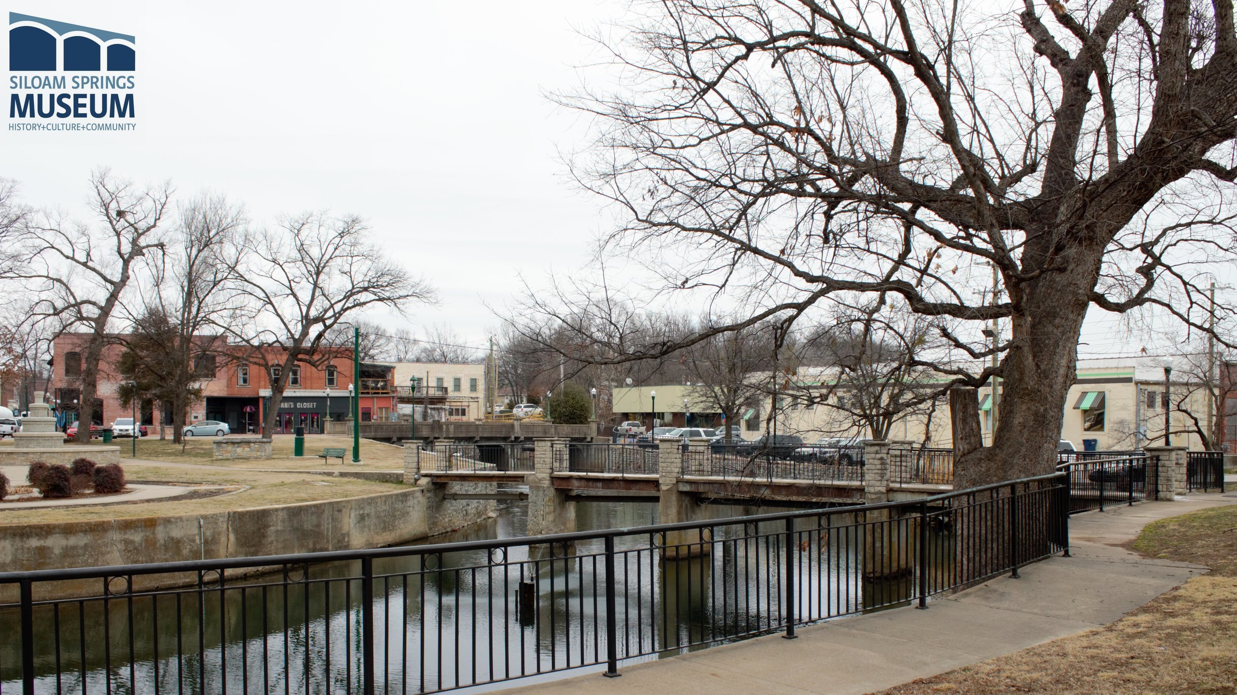
Modern photo from the south bank looking toward the Twin Springs foot bridge.
EDIT 5/26/18: Museum staff found another photo of the August, 1928 flood elsewhere in the archives. This photo was taken from the bluff above Twin Springs Park.

Written by Chuck McClary from research by Don Warden